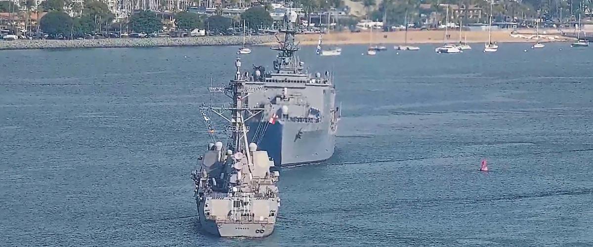
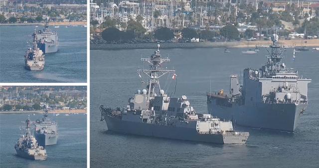
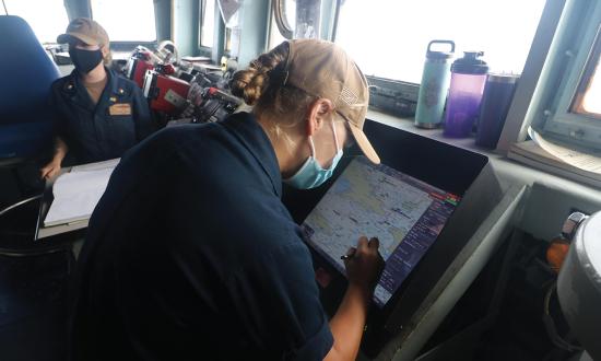
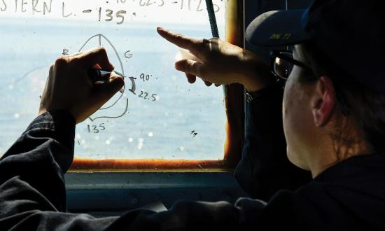
Though U.S. Navy warships regularly meet other vessels in restricted waters when entering and exiting port, these events are far from routine. The near miss between the USS Harpers Ferry (LSD-49) and Momsen (DDG-92) on 29 November 2022 in San Diego Bay is a reminder that such meetings are hazardous and require the utmost attention when planning and executing. The vessels barely avoided collision because neither proposed a meeting location.1 As a result, additional Navy type commander requirements for verifying harbor movements and determining meeting locations may be forthcoming.2
Regardless, appendix B of the Navigation Department Organization and Regulations Manual requires that anticipated traffic is presented during the navigation brief.3 To meet this requirement, ships should be computing the expected meeting points with other vessels and presenting them at the navigation brief. This process has the added benefits of bringing potential issues to light, such as a meeting in a narrow part of the channel or close to a turn, and creating a shared mental model among watchstanders as to how the ship will meet those vessels.
Calculating Vessel Meeting Points
Three pieces of information are required to anticipate the meeting point with another vessel: the port schedule, the route to be taken, and the time-speed-distance formula. The equation below shows the relationship between time in minutes (Tmin), speed in knots (Skts), and distance in yards (Dyds).
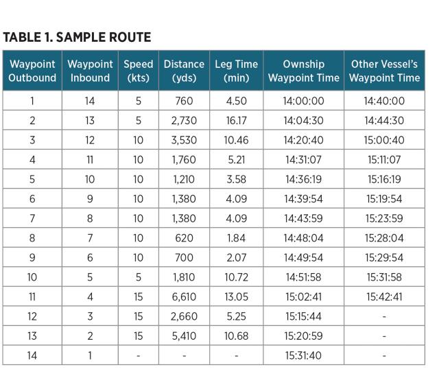
Table 1 shows a sample route with the waypoint numbers, leg distances, leg times, and estimated times of arrival (ETAs) at each waypoint calculated using the equation. For example, our ship is getting underway at 1400. The other ship is embarking a pilot at the sea buoy (inbound waypoint 14) at 1440 before heading inbound to a location in the vicinity of outbound waypoint 4. The first task is to determine whether our ship will meet another vessel. To determine this, our ship must pass or be passing the other vessel’s destination by the time that vessel arrives at its destination and our ship must be conducting its transit when the other vessel begins its transit. For example, our arrival time at the other vessel’s destination is after the arrival time of the other vessel at its first waypoint. When calculating the meeting point, it is assumed the other vessel will follow the same route and transit at the same speeds as our ship. The procedure for calculating the meeting point is as follows:
1. Calculate the estimated times of arrival for each vessel at each waypoint (provided in Table 1).
2. Determine our ship’s location when the other vessel starts its transit.
3. Compute the transit time from our ship’s location at the time of the other vessel’s start and the location where the other vessel is starting.
4. Divide the time in step 3 by 2.
5. Determine where our ship will be at the time from step 4.
In the example provided in Table 1, our ship will be in the vicinity of waypoint 6 when the other vessel begins its inbound transit at waypoint 14. The total transit time between waypoints 6 and 14 is 51 minutes and 46 seconds. Thus, we will meet 25 minutes and 53 seconds after 1440, or at about 1506. At 1506, our ship will be in the vicinity of waypoint 11. With some interpolation, we can further refine our result to estimate that we will meet the other ship 2,034 yards past waypoint 11.
Once our transit commences, it is important to listen for a sécurité call and monitor the other ship’s position and speed in the automatic identification system (AIS) or by radar track. This information can then be used to modify the predicted meeting point. Although this process assumes that no speed changes will be made along the route, it is accurate enough to predict the general location of the meeting point for the purpose of making passing arrangements:
1. Determine how much farther our ship has to travel before the next waypoint.
2. Add the distances of each leg between the next waypoint and the waypoint in vicinity of the other vessel.
3. Divide the distance along the route by the combined relative speed of our ship and the other vessel’s speed provided by AIS or radar.
4. Divide the time in step 3 by 2.
5. Add the time from step 4 to the current time.
6. Determine where our ship will be at the time from step 5 by checking the estimated time of arrival at the route waypoints.
To continue safely navigating ships, crews must be prudent in their preparation for and arrangement of safe passage in restricted waters. Calculating meeting points is a core competency of navigation that enables this. Given that Navy type commander requirements may soon impose additional requirements on ships to avoid collisions or near-misses, bridge watchstanders should learn (or relearn) this process and become proficient in it.
1. Department of the Navy, Naval Surface Force/U.S. Pacific Fleet, “Preliminary Inquiry into the Near-Miss Collision Between USS Harpers Ferry (LSD-49) and USS Momsen (DDG-92),” 26 January 2023.
2. “Preliminary Inquiry.”
3. Department of the Navy, Naval Surface Force/U.S. Pacific Fleet, ComNavSurfPacInst 3530.4G, Surface Ship Navigation Department Organization and Regulations Manual, 28 October 2021.


