
In the July 2020 Proceedings, Dr. William Williamson argued that satellite constellations are disrupting current naval strategies, advancing them from games of battleship to games of chess by making the oceans completely observable. He offers that to make the data these constellations provide truly useful will require naval forces to “exploit advances in machine learning and artificial intelligence to recognize situations and make sense of vast quantities of new information at a speed that enables timely decision support.”1 In effect, he is stating that a newly fielded technology might never reach its full potential because the data it amasses is too much to decipher.
NATO’s Science and Technology Organization refers to this as big data and advanced analytics (BDAA).2 To make satellite and other such sensor technologies disruptive will require an equally disruptive approach to analyzing and disseminating the data they collect, one that can be operationalized in real time by units at sea. The National Marine Electronics Association’s (NMEA’s) electrical and data specifications provide a viable solution for integrating sensor data to meet many BDAA demands. If fully capitalized on, NMEA 2000 (N2K) networks present an internet of things (IoT) that, when interfaced with information technologies, allows computing, customized visualization, large-capacity data storage, and integration with mobile networks and cloud computing.
The interpretation of satellite data from the Automated Identification System (AIS) and the National Oceanic and Atmospheric Administration’s Vessel Monitoring System (VMS) are examples of the challenges in operationalizing such data. AIS supports collision avoidance and VMS the enforcement of federal fishery laws and regulations.
Though monitored by special receivers fitted to satellites, AIS was designed to integrate a vessel’s VHF transceiver with NMEA data from other installed systems, such as its GPS and heading sensor, to transmit information such as identity, position, and movements to other vessels and shoreside base stations. The International Maritime Organization requires AIS on ships of 300 or more gross tons and all passenger ships regardless of size. The United States extends the requirement domestically to most commercial vessels measuring more than 65 feet. By contrast, VMS is entirely satellite-based; vessels automatically send reports at regular intervals to support enforcement efforts. Both VMS and AIS amass large amounts of data quickly, which between the two systems could number more than 8,500 unique and simultaneous transmissions every minute.
Though data can enable mapping much of the vessel traffic in a geographic area, without analysis and correlation its utility is limited. For example, VMS satellite data is integrated with a web-based geographic information system but lacks features for automatic real-time display on a patrol vessel’s Electronic Chart Display and Information System (ECDIS) or multifunction display (MFD). AIS receivers on vessels are integrated with ECDIS and MFDs but limited to receiving VHF transmissions within line of sight. Because of its integration with ECDIS and MFDs, AIS offers at least some immediate operational utility and can be correlated with optical imagery, such as that provided by a forward-looking infrared camera, and radar, with the Automated Radar Plotting Aid (ARPA) providing a near-redundant check for accuracy.
Unfortunately, this operational picture is not shared, a condition well described by Commander Craig Allen in his August 2019 Proceedings article, “Connectivity Maketh the Cutter.”3 Shoreside command centers have access to web-based systems showing satellite and historical target track data but no data from sea-based sensors, while the reverse is true for patrol vessels offshore. Increasing the capability to send, receive, store, and analyze real-time AIS, radar, imagery, and other sensor data would remedy these shortfalls.
The Need for BDAA
BDAA requires four components: sensors, communication, analysis, and decision-making. Making sense of large amounts of data is challenged by the five Vs: volume, velocity, variety, veracity, and visualization.4 Consider how the Coast Guard could employ satellite-received AIS signals to identify incursions into the nation’s exclusive economic zone occurring 200 nautical miles from shore. Accessed and viewed in a web-based system, the AIS data for a foreign fishing vessel is displayed as a triangle on a basic map, with no jurisdictional lines and no electronic navigation or raster navigational chart overlay. The commercial database linked to the web viewer identifies the vessel only by its Maritime Mobile Service Identification (MMSI) number, requiring watchstanders to access another government database system to determine its flag, identity, and history.
With no ability to plot a position in relation to the EEZ boundary on the web viewer, watchstanders must convert the position for use with an unrelated geographic information system software or even plot the position on a paper chart using a compass and divider. On confirming the vessel’s flag and position, the position must be radioed to a patrol vessel along with orders to intercept. On board the patrol vessel, the position is entered into ECDIS or an MFD, on which it is graphically displayed on an electronic navigation chart and verified by a radar overlay. None of this is viewable by shoreside watchstanders, and all must be documented with camera imagery—typically with a smartphone—and, once in range of the phone’s cellular service, transmitted to the command center to support case prosecution. Mapping the vessel’s historical track and that of others in its fleet to identify trends also takes substantial time and work across multiple systems.
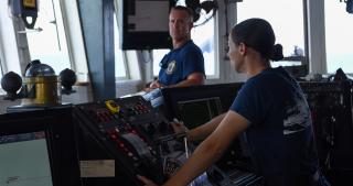
The lack of BDAA keeps satellite technologies from being used to their full potential. But most of the capability to integrate sensor data already exists on board patrol vessels. A vessel’s onboard sensors and graphical displays are networked according to N2K data and electrical standards, which support gateways that further connect serial, ethernet, and wireless devices and networks. Devices that meet the N2K standard and are used by virtually all fielded marine electronics are connected to one central cable—a backbone—that powers most of the devices and relays data between them. Interfaces installed on the backbone further allow connections to engine monitoring systems, while gateways connect the high-speed ethernet networks required for sharing large amounts of data from radar imaging, sonar, and video cameras. Gateways also allow USB and WiFi connections that can transfer data from the backbone to any connected computer, tablet, smartphone, or wearable device, and enable it to join other physical networks.
Gateways also have the capability to convert N2K’s compact binary message format into NMEA ASCII sentences, allowing a wide variety of data to be shared with NMEA-compatible software and web-based or cloud applications running on connected devices. The N2K fast-packet protocol allows streaming up to 223 bytes of data per second. With each packet approximately 8 bytes, the drain on available bandwidth is negligible as even a constant month-long stream of NMEA data is unlikely to exceed 8 gigabytes when compressed, freeing bandwidth for other net functions.4 All data received can be stored, whether to a connected device’s memory, to a microSD card, to the cloud, or to some combination of these, resolving the problem of storing large amounts of data.
Multifunction displays on the N2K backbone and computers, tablets, smartphones, and wearables connected to it via WiFi act as the visual hub for the onboard networks. Screens allow customization of their software’s graphical user interface and purpose-built web pages. These solve many of the visualization, understanding, insight, and decision-making problems inherent in ingesting and correlating large amounts of disparate information. Stored in the device’s internal memory or on an SD card, elements such as nautical charts and satellite photos can be overlayed with or displayed alongside custom datasets from all networked devices, including GPS, radar, sonar, AIS, depth, navigation information, and target-intercept data.
Because this can be accomplished on mobile and wearable devices, crews can interface with the systems and data both on board and remotely through cloud services. Augmented reality is also possible with several brands of commercially available sunglasses, all integrated with an iOS device connected to the N2K network’s WiFi, displaying data in multiple layout styles. These devices further provide limited command functionality through a touch interface, allowing wearers to perform tasks such as dropping waypoints, controlling timers, and advancing navigation points.
BDAA efforts on N2K have the potential to create a decision advantage for the Coast Guard and other maritime forces whose cutters and boats are already an IoT, fitted with onboard sensors and satellite receivers built to N2K specifications. WiFi gateways would further allow crews to benefit from ubiquitous computing and augmented reality, improving safety and efficiency. N2K is the best and most cost-effective solution to the challenges of BDAA for maritime forces as sensors improve and the amount of data they generate grows.
1. William Williamson III, “From Battleship to Chess,” U.S. Naval Institute Proceedings 146, no. 7 (July 2020).
2. NATO Science and Technology Organization, Science & Technology Trends 2020–2040: Exploring the S&T Edge (Brussels, Belgium: March 2020).
3. CDR Craig H. Allen Jr., USCG, “Connectivity Maketh the Cutter,” U.S. Naval Institute Proceedings 145, no. 8 (August 2019).
4. Allen, “Connectivity Maketh the Cutter.”


