
Navy doctrine relies on the assumption that the service will be able to attain and sustain information superiority over adversaries.1 Superiority is a relative term, however, and the exponential increase in information available to potential foes poses a serious challenge to the United States’ ability to maintain its information advantage. This is particularly true as space-based information, from military and even commercial satellites, is becoming available to all. The rapid development and deployment of highly capable small satellite constellations soon will render the oceans completely observable.
The uncertainty that historically characterized naval operations is captured by the game Battleship, played with pencil and paper and popular with military officers in the early 20th century, before the Milton Bradley company introduced a board game version in 1967.2 A completely observable ocean that allows each competing naval force to view all its opponent’s forces at all times will require strategies much more complex than those employed in the game Battleship—and more like those of chess.
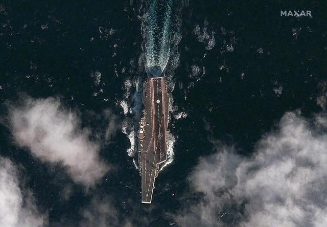
The large-scale introduction of highly capable sensors deployed in low-earth orbit constellations of small satellites (smallsats) will expose in fundamental ways the activities of commercial and naval vessels. Global, high-definition, persistent, and real-time sensing from hundreds of low-earth orbit remote sensing smallsats will reveal ships by observing their physical and signal characteristics and tracking movements. This live stream of physical and signal information will be available as a commercial service.
At the same time, constellations of thousands of networked communication smallsats will bring wideband internet access to all seafarers, enabling oceanwide access and bandwidth, making every ship a sensor in a global network of ship tracking, activity monitoring, and sharing.
The transparency provided by these ubiquitous overhead constellations will disrupt and force modification of naval operations, transforming the behavior of fleets in peacetime and in war.
"In 2015, the CIA’s investment arm, In-Q-Tel, declared: “The new space race is on.”
The Smallsat Disruption
From the 1960s to the early 2000s, space-based surveillance of the oceans was the exclusive domain of nation- states. The first U.S. application of such surveillance was to monitor the Soviet Union’s strategic nuclear capabilities, concealed deep within Soviet territory and effectively unobservable by conventional collection systems. Later satellites enabled the observation of emissions from radars on the ground and on naval combatants. In the ensuing decades, space intelligence-collection capabilities improved steadily.
But during Operation Desert Storm in 1991, the Department of Defense (DoD) criticized the intelligence community for its inability to deliver timely information of critical tactical value from these assets to operational forces.3 To correct this, the Pentagon worked with the National Reconnaissance Office to create “tactical exploitation of national capabilities” programs within each service to expedite intelligence delivery from the strategic overhead collection systems. DoD and NATO also considered developing smaller tactical satellites to close the gap between strategic reconnaissance and tactical surveillance missions.4
Meanwhile, between 1981 and 2000, there was a dramatic reduction of satellite weight—decreasing by a factor of about two every eight years, thanks to advances in four key technology areas:
Structure. Carbon and graphite structures, nanomaterials, honeycombs, metal matrix, and metal resin composites all enabled strong, lightweight satellite structures and thereby larger payloads.
Power density. Continual improvement in the efficiency of multiple junction solar cells, coupled with higher energy density nickel-hydrogen batteries and improved power conversion and distribution efficiencies, resulted in more onboard power.
Attitude control. Reduction in the size, weight, and power of star sensors, reaction wheels, control moment gyros, magnetometers, inertial reference units, and thrusters enabled better Earth-pointing precision at lighter weights.
Computational power. Moore’s Law (the doubling of processor speed every 18 months) enabled orders-of-magnitude improvement in onboard computation for sensing, mission management, and communication.5
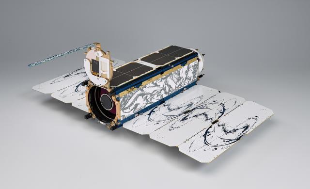
In the early 2000s, civilian space agencies and the academic research community began developing smaller, cheaper satellites for research and Earth-sensing missions. The standard “cubesat” size—10 x 10 x 10 cm (1 unit or 1U, weighing just over 1 kg)—was established, and smallsats were modularized to 1U, 3U, and 6U sizes.6 Larger smallsats, weighing up to 250 kg, were modularized with plug-and-play components and payloads. Between 2012 and 2017, more than 475 commercial smallsats were launched, and U.S. companies manufactured 90 percent of them.7 In 2015, the CIA’s investment arm, In-Q-Tel, declared: “As space services become the realm of startups, not just governments, the [intelligence community] and its partners must consider the implications. . . . The new space race is on.”8
Universities, commercial companies, DARPA, and the Navy and the other services developed and launched smallsat capabilities. Enabling this explosion has been the introduction of new low-cost small satellite launch vehicles (SSLVs) and the use of “ride-share” methods to carry many smallsats to orbit alongside primary payloads. (Like Uber and Airbnb, this mode exploits an un- or underused asset: excess capacity on launch vehicles.)
The smallsat revolution continues to gather capital investments and commercial development of satellite constellations and launch vehicles. Annual on-orbit delivery rates are expected to exceed 400 smallsats per year between 2020 and 2024, expanding existing constellations as well as introducing new ones. The market analysis firm SpaceWorks estimates 1,800 to 2,400 smallsats in the 1 to 100 kg range will require launch over the next five years.9
Consider just a few of the current and projected smallsat types:
Electro-optical imaging. Planet Labs operates a “flock” of more than 150 cubesats, offering 3-meter resolution of any spot on the globe at least once per day. Competing constellation concepts—with greater revisit, spectral imaging, and video capabilities—are being funded as well.
Radar imaging. Two commercial firms are now building synthetic-aperture radar (SAR) constellations to image the oceans with high-resolution, cloud-penetrating radar sensors. Capella Space is building a 36-smallsat constellation to provide hourly revisits with resolution up to 0.5 meters. ICEYE, a Polish-Finnish venture, is building a SAR smallsat constellation that will provide average revisit rates of three hours with “stripmap” (search) and “spotlight” (identify) imaging modes that provide imagery at up to 1-meter resolution.10
Signals intercept. Commercial firm Hawkeye 360 operates a small constellation of signals-intercept smallsats to locate and track radio-frequency emitters: ship automatic identification systems (AIS), marine radar, satellite communications, VHF radio, and emergency beacons.11
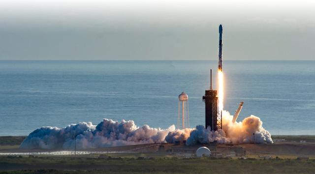
Broadband internet. The drive for market competition can perhaps most clearly be seen in the competition to provide global broadband internet coverage. Two giants—Amazon and SpaceX—are contending with numerous other players. Amazon plans to launch more than 3,200 satellites for its Project Kuiper constellation, and SpaceX recently obtained authorization to field almost 12,000 for its Starlink constellation. SpaceX plans to distribute a million small terminals to mobile users, and these can be used at sea.12 Such intense competition is sure to keep availability high and prices low.
In this new era, “sensing as a service” will put high-resolution day/night/all-weather imagery in the hands of any potential adversary able to pay the (modest) market price. The commercial Earth-sensing market serves a number of very powerful economic sectors, all of which demand ever more data to serve their analytic needs to gain a financial edge. These sectors include agriculture, mining, transportation, and others. Government entities of all sizes use space-based data for purposes such as urban planning, disaster management, and even tax assessment.
The Observable Ocean
In the 20th century, decisive advantage in naval engagements generally went to whichever force was able to gain superior knowledge of the status of the opposing force and attack first. The Battle of Midway is a classic example. As the Japanese and U.S. fleets approached each other near the atoll, it was essential to locate the enemy precisely enough to launch a strike. Thanks to good intelligence estimates, the U.S. fleet received a report from a land-based PBY patrol aircraft at about 0530 on 4 June 1942 and began preparing to strike at the Japanese carriers. The Japanese did not locate the U.S. fleet until after 0730 that day. The information superiority resulted in a decisive victory for the U.S. Navy.
From World War II to the present, carrier strike groups have relied on indigenous sensor capabilities—surface vessels, submarines, aircraft, and UAVs—to conduct search and screening operations augmented by space-borne assets and, when possible, land-based patrol aircraft.13 Combined, these assets provide a powerful intelligence, surveillance, and reconnaissance capability, but it is limited in how much time and space it can cover. Still, for more than six decades the Navy has enjoyed technical and operational superiority in the air, sea, and space domains, allowing it to maintain superior situational knowledge. The smallsat revolution changes that.
On the “observable ocean,” the Navy must assume that every combatant will be trackable, with position updates occurring many times per day. Never again will it face an enemy incapable of locating the U.S. fleet beyond the horizon. In short, the Navy will have lost the advantages of invisibility, uncertainty, and surprise. The level of detail available to adversaries will enable them to fuse multiple modes of information—imagery, radar, and signals—not only to determine ships’ locations, but also to infer the health and operational status of the vessels and to monitor logistical considerations.
Vessels will be observable in port, and the number and type of supplies brought on board will also be subject to near-real-time observation. When a ship departs, the preparations will be noted and the time of departure known to within hours or even minutes. This is true for submarines as well as for surface ships. These new capabilities, coupled with at-sea surveillance buoys possessing continuous wideband access to a global network, might also render some underwater regions transparent.14
The availability of broadband internet and wideband communication at any point on the open seas is another significant aspect of the commercial revolution in smallsats. Until today, very few ships at sea have had broadband access, and even naval vessels have been constrained by oversubscribed, fragile satellite communication links. The arrival of constellations such as Starlink will provide uninterrupted, low-latency broadband communications for anyone who subscribes. This effectively spells the end for aspects of the Navy’s current information superiority at sea. It also expands and complicates cyber defense in the maritime domain. As in the world of industrial control systems, many smaller vessels, such as fishing boats and small freighters, will not be equipped with adequate cyber security, making them susceptible to being co-opted into maritime botnets and potentially turning them into hazards to navigation—or worse.
The Army adopted the “every soldier a sensor” concept for a time in Iraq. A maritime analog—every ship a sensor—would allow the world’s merchant ships of all sizes and classes to contribute their radar and observations through the internet to a global smallsat-driven fusion system. The Navy’s quest for global maritime domain awareness could now become a commercial reality if these capabilities can be harnessed.
The Response
An observable ocean will significantly change naval operations, and today’s game of Battleship will give way tomorrow to chess when every player can see the gameboard clearly. In that case, the advantage will go to the strategist who can best foresee future moves, understand environmental factors, and take the most rapid, decisive actions to achieve the advantageous position most consistently.
In this future environment, the victor must achieve a speed-of-decision and operational advantage. The strategy must be twofold: improve the accuracy and speed of our decision capability and degrade the adversary’s. Denial and deception will still be possible, despite the large amount of information available to the adversary. Indeed, providing truth to the adversary is a key element of making a deception strategy appear plausible.15 Since U.S. naval forces can no longer avoid observation, they must use the vast data available to the enemy to employ feints and misdirection, leading him to believe that what he plainly sees indicates something other than U.S. forces’ true intent or capability.
The Navy must therefore shift its strategic thinking from information superiority to decision superiority. It must embrace the new reality, in which depth of knowledge and speed of decision will control the ability to win decisively. This will require the Navy to:
- Exploit advances in machine learning and artificial intelligence to recognize situations and make sense of vast quantities of new information at a speed that enables timely decision support.
- Master the art of denial and deception (D&D) in the new observable ocean environment. Offensive D&D mechanisms expand in growing information environments, and counter D&D capabilities must keep up.
- Expand information operations capabilities to operate in the new commercial broadband environment.
- Develop cyber-security strategies to harden these new network-enabled capabilities against potential threats to critical Navy infrastructure.
Last, the Navy must adapt acquisition strategies to innovate, so as to combine U.S.-unique collection capabilities with commercial ones to ensure faster and more-in-depth information is available to U.S commanders. To do so, it will need to:
- Track commercial and foreign advances in satellite technology and constellation deployments and consider the potential threat posed by each.
- Plan to adapt the commercial smallsat products for Navy-specific uses.
- Invest in research and development to make certain U.S. smallsat technology leadership is focused on developing smallsat constellations that will provide the United States with unique advantages.
These actions will help the Navy ensure that the inevitable transparency of the ocean will not nullify its advantages at sea and will allow it to exploit the new information-rich environment, leveraging it to create new operational concepts.
1. Department of the Navy, “Information Superiority Vision.”
2. Jeffrey P. Hinebaugh, A Board Game Education (Lanham, MD: R&L Education, 2009).
3. U.S. House of Representatives, Oversight and Investigations Subcommittee of the Committee on Armed Services, “Intelligence Successes and Failures in Operations Desert Shield/Storm,” 103rd Congress, 16 August 1993.
4. “TacSats for NATO (Les Satellites Tactiques pour OTAN),” Agard Advisory Report 322, February 1994.
5. Pete Rustan, “Developing and Maintaining the Innovative Edge,” High Frontier (Air Force Space Command) 3, no. 3 (May 2007).
6. In 1999 DARPA and the Air Force funded Stanford University’s Orbiting Picosatellite Automated Launcher (OPAL) experiment to deploy very small satellites. Robert Twiggs developed OPAL’s first smallsat and defined the 1U standard.
7. “Smallsats by the Numbers 2018,” Bryce Space and Technology, March 2018.
8. Ryan Lewis and Todd Stavish, “Cosmic Shift: The Commercial Space Revolution,” IQT Quarterly 6, no. 3 (Winter 2015): 3.
9. “Nano/Microsatellite Market Forecast” (10th ed.), SpaceWorks, February 2020.
10. For descriptions, see www.capellaspace.com and www.iceye.com.
11. For a description of the Hawkeye constellation, see www.he360.com.
12. The key patent for the Starlink constellation is Mark Krebs et al., [Google] Satellite Constellation, U.S. Patent Application US 2017/0005719 A1, 5 January 2017. The key patent for the small stabilized phased-array terminal antenna is Mazlouman (Space Exploration Technologies Corp.) World Intellectual Property Org. Patent pub. No. WO 2018/152439 A1, 23 August 2018.
13. Kent R. Schneider, “The Unique Character of Naval ISR,” AFCEA Signal, December 2013.
14. For example, DARPA’s Tactical Undersea Network Architectures (TUNA) program is developing technologies for at-sea networks of buoys that could be adapted for surveillance with the addition of simple wideband terminals.
15. Michael Bennett and Edward Waltz, Counterdeception Principles and Applications for National Security (Boston, MA: Artech House, 2007).


