The following is transcribed from the “pocket diary” logbooks and journals of the author, then-Lieutenant Peter Hutchinson, U.S. Navy, who was first assistant to and then operations officer on board the icebreaker USS Glacier (AGB-4) during the Navy’s Deep Freeze operations of 1960–62 and drafted the ship’s operations report. Home-ported in Boston, the Glacier was largest and most powerful icebreaker in the world of its time. It was transferred to the Coast Guard shortly after Hutchinson’s tour of duty and used for a brief time in Arctic operations. It remains a seminal part of Hutchinson’s life and career; few of the individuals involved are still alive at the time of this writing.
USS Glacier (AGB-4)
I was above the Arctic Circle in 1960 when ordered to the Navy icebreaker USS Glacier (AGB-4), out of Boston. I was helicoptered to an accompanying aircraft carrier, then flown to London, where I got a Navy flight to the States for the icebreaker’s voyage south to New Zealand, our “home port” for the trip. By December, the same year, the Glacier had broken a channel through the ice of McMurdo Sound in the Ross Sea, Antarctica.
This was the Navy’s “Operation Deep Freeze,” supporting polar science and discovery, scientists, and researchers in Antarctica. The Navy had done much earlier explorations; Captain Charles Wilkes, U.S. Navy, is credited with sighting the continent’s land mass in 1840. I had joined the Navy in 1954 with a yen for travel; I did see a lot, but not Antarctica, which brings us to now and the USS Glacier.
In September 1960, the Glacier left Boston, arrived at Port Lyttelton in October and left for McMurdo Sound. We were part of a task group that included another icebreaker, the USCGC Staten Island (WAGB-278), with our commodore being Captain Edwin McDonald, U.S. Navy. After breaking channel through McMurdo Sound in the Ross Sea, we were back in New Zealand in time for Christmas. McMurdo Station is jumping-off point for American activities in the Antarctic; from here, in the shadow of volcano Mount Erebus, aircraft flew personnel and supplies to far-flung scientific bases like the South Pole Station, more than 700 miles inland. Traverses journey across the frozen and treacherous terrain to Byrd Station, 85 miles away. From McMurdo, U.S. Navy ships commenced voyages of exploration and discovery along Antarctica’s ice-bound coast. Carrying scientists and technicians, their crews made real the motto of “Seapower supports science.”
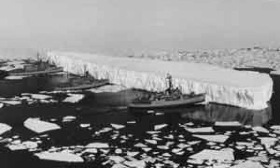
I saw my first iceberg early in December, at about 62 degrees south latitude. It was in the distance but appeared large, although thirty miles away. There was no mistaking it: flat and white, termed as “tabular” for its shelf-like shape, different from the angularity of Arctic icebergs. These tabular bergs are broken off from ice shelves, a peculiarity of the Antarctic regions. The shelves themselves are formed by the steady growth of ice over a period of a hundred or more years. The Ross Iceshelf, a landmark, varies between 60 and 120 feet in height, and is 400 miles long. The tabular bergs “calve off” the “mother” ice and float away in the Antarctic summers; the largest one sighted so far is over 100 miles long. When the icebergs break off, the loss of their weight tends to raise the continent, exposing rifts and islands.
From my logbook and report draft, we arrived at Wellington, New Zealand, on January 3, 1961 after breaking channel at McMurdo Sound in Antarctica, entering dry-dock for replacement of blades on our twin screws, and by the end of the month were enroute south to the Amundsen Sea.
At McMurdo Station, scientists and observers were put ashore to measure ice and establish locations of presumed islands surrounded by ice, using theodolites, radiosondes and the ship’s two helicopters. Proceeding along the Eights Coast, “we passed icebergs, exposed rock, islands, [and] shore parties taking theodolite fixes.”
On the 10th of January, “The Task Group’s trail party found site of scientific party about 60 miles from ship. Went hiking up local hill of iceshelf with others - got rock samples, saw crevasses, also mountains in distance, no names . . .” The hill was about a mile high but with a 3–4 mile slope beginning with the ice shelf. I was a bit scared—the path along the crevasse was narrow, and a fall would be about two thousand feet - with no way out (if you did survive)! My sample of rock had lichen on it.
February 1961
On 2 February, there were “numerous large to medium icebergs,” and two days later we were in “loose pack ice—5/10 coverage, rotten. By noon, 9/10ths—about 4–5 feet thick (1.5 foot snow cover), still some good-sized bergs.” 7 February, “lying to off ice shelf; exposed rock off to starboard.”
The breeding place of the bergs is the great ice shelves, the birthplace of the bergs. Their burial place is a great granite tomb looming grayly in the fog, an uncared-for graveyard, the stones uprooted, tilted by seasons and upheavals. They sweep majestically out to sea, great trails of brash, cutting a swathe in the pack of ice, relentlessly moving along, more by currents than by wind. On the horizon, they form a surrealist landscape—or is it seascape? The dark silhouettes of bergs loom against the dusky horizon and last few streaks of twilight. They are grounded, like some poor hulk of a ship, uptilted from the force of collision into positions of unhappy, unnatural, angularity; are decrepit with age, edges worn down to pancake thickness, pitted and eroded from wind and currents, weathered and greying like old and bad teeth, all sharpness gone.
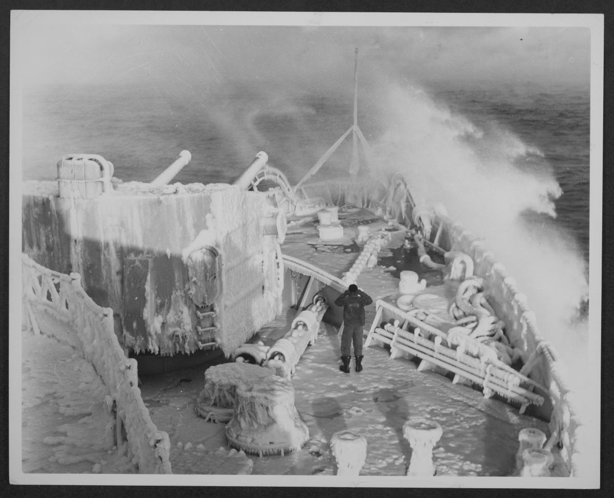
On 11 February, the Glacier was in the Bellingshausen Sea, the southernmost extremity of her explorations. Closed in by thick and hummocked ice, she collected oceanographic data; shore parties established locations of features, rock samples were collected, bird and sea life recorded. The weather, however, was finicky: “12 February, barometer began falling,” on Monday “snowstorm—wind 50–60 knots, gusts higher, visibility zero - shore party still over.” Winds got as high as 100 knots; the shore party was caught out in this storm, and helicopters were sent to recover it. All the scientists were in good condition but tired, cold, hungry. The party had been out three nights, two days, some 60 hours. Dr. Brian Roberts, ornithologist and head of the British Polar Institute with us is credited with their survival—they built a rock shelter from the winds. One of their two tents had burnt down the first day while getting set up. On the 16th, a helo sent to recover gear from the site caught fire itself and crash-landed.
The rest of February was a matter of slow progress along the coast and “beset as before” became a constant in my logbook. “Beset” means closed in by ice; “breaking through” sometimes meant “used blasting to open up leads.” On the 24th, we detected unknown radio signal on radio direction-finding equipment 326 degrees—believed to be Russian language. Signal very strong. Unknown signal being transmitted at varying intervals. This believed to be Soviet whaler emitting weather and personal messages. No location position arrived at.” On this date also, “we begin to talk (mostly in jest) about possibilities of wintering over in this area if we really got stuck in this ice. It could conceivably happen—and we all know it. Patience is the big virtue of the icebreakers—don’t fight the ice unless you have to—wait for it to literally give in.”
Then, after slow progress, we were “Breaking ice as before. Visibility 100 percent (All around horizon.) The motor whaleboat put in the water to check propeller blades. (The starboard had one blade broken, two bent; port okay.) We stopped to repair a fuel line. Ships were icebound for the past four days. At 0300 this morning, we had the lowest temperature so far, -2 degrees, high of 19 degrees.
March 1961
The month of March was exploring (some would say “fighting”) through the brash ice of the coast as far as the Antarctic (Palmer) Peninsula, beyond Thurston Peninsula (which was proven to actually be an island). On the 3rd, “various courses and speeds to maneuver out of the ice following the Thurston coast, heavy close pack to starboard.” On 5 March we were beset in the Bellingshausen Sea, closed in by heavy pack ice, with no cracks or leads. The ice was 10–12 feet thick, the “open” seas totally covered by brash, block, and many rotted floes. “Arctic sea smoke” was prevalent—the peculiar ground fog of polar areas when very cold air flows over a warm moist surface, in this case the ice.
On the 13th, we “bypassed Victor Hugo Island and by nightfall were in “South Bay, Doumier Islands, Bismarck Strait.” On the 14th we encountered an Argentine station and beacon. “In Paradise Harbor, in the Gerlache Strait, we were near the Chilean meteorological station,” and on the 17th were in “Admiralty Bay, South Shetlands - British meteorological station, vacated earlier this year.” We suddenly saw its blinking automatic lights, and anchored near, viewing the eerie sight as a welcome sign of life, if not activity.
On 21 March, we had “heavy rolls . . . C.O. got thrown out of bunk—[he had a 15 inch wound] on [his] forehead.” Next day, “steaming around the Treversay Islands, had easier rolls. At 56–16S, 27–06W, we recorded the Meteor Deep, a 4,000-fathom trench.” And then, after a few days of “high seas again” we were on our way north. After visits to Montevideo and Rio, we returned to Boston on 27 April. We had “one-day postmark” to commemorate our penetration of the Amundsen Sea, had penetrated the “unknown” Eights Coast, beyond earlier explorations, and observed new (to us) islands and peaks, charted the coast.
Deep Freeze 62
“Deep Freeze 62” began in October 1961 when we departed Boston, with a crew of 233 [and] 18 officers. We departed Port Lyttelton on 9 November enroute to McMurdo, with Captain Edwin A. McDonald, Commander Task Unit 43.1 embarked. There, helicopters, especially from the USCGC Eastwind (WAGB-279), were being used for ice reconnaissance ahead of the group, used our radar to note their position and comments as to ice conditions ahead. They were showing us features 20 miles or more away, radioing it back to the ship’s CIC—which put it on the DRT plot and passed it up to conn aloft. “Past 24 hours averaging only 4.2 knots. No night at all now, almost as bright at midnight as during the day. 26 November, have 7.5-foot ice, and 3,500 yards to go for our intersection.” (4.5 miles to Hut Point). I visited the Cape Royds rookery today—[Adelie penguins] there. New Zealand ornithologists are living in Shackleton’s hut as a base for their studies of the rookery. They have numbered most of the rock-pebble nests, and painted numbers on many penguins—to determine whether birds return to the same nests each year and to spot changes in nesting habits during a single season.
On 2 January 1962, we came out of dry-dock, departed Wellington and Port Lyttelton again for McMurdo Sound, arrived on 11th. Broke channel for supply ships, and again activated Task Unit 43.1.2, for our Bellingshausen Sea and Marie Byrd Land expedition.
Weather deteriorated at Kainau Bay, but we were heading for ocean stations (with 40-degree rolls). We landed a shore party at Little America V, and in Sulzberger Bay a survey party of geographers on the Scott nunataks. The CO flew for recon of Guest Island area. We did radar plotting of evidently new islands (One of these was later named for me by the Advisory Board, U. S. Geographical Names), and took aerial photos of the coastline in open water off fast ice areas. We had followed the track of Admiral Richard E. Byrd’s ship USS Bear (AG-29) and went further south than had been done before. The event was recognized with another “first-day” postmark.
On 1 February 1962, we “put a shore party near an unnamed peak adjacent to Cordell Hull Glacier” then “headed northeastward. Many bergs, heavily hummocked ice and floes, following leads. Open water off Getz Iceshelf, moving eastward to Shepard Island, plotting coastline. . . . directed to return McMurdo to assist with ops there.” On the 7th, we “picked up USGS party at Little America. Very foggy, coldest -20 degrees.” Enroute to McMurdo, we “completed radar photos of Ross Iceshelf (to Cape Crozier),” and there, moved “alongside Burton Island to transfer fuel.” On the 14th, the ship broke a mooring site for the USS Elkhorn (AOG-7), and on the 18th, “CTG 43.1 shifted his flag to McMurdo Station.” It was “blowing hard when the Glacier attempted to assist supply ship (the USS Arneb [AKA/LKA-56]) by putting our bow against her side to facilitate her offload—but the situation too unwieldy. A floe with men and tractors broke loose, nudged it near fast ice so they could escape.”
By March 15th, after returning to New Zealand for repairs, we were “underway, enroute the vicinity of the ice-bound ship Republic of South Africa off Queen Maud Land.” On the 19th, the Republic of South Africa was reported at “68-18S, 04-44W, in hummocked ice, being carried by northwest currents.” The Glacier was some “3,542 miles to ship’s position” when the Republic of South Africa reported “ice much broken up with many cracks, still unable to make progress.” Then, on the 23rd, we received word that the ship “was free, no longer needing an assist”—but we were invited to Capetown, and from there went home. It was 5 May before we arrived in Boston. On the 10th, I was detached from the Glacier, having been far north, far south and in-between.


