
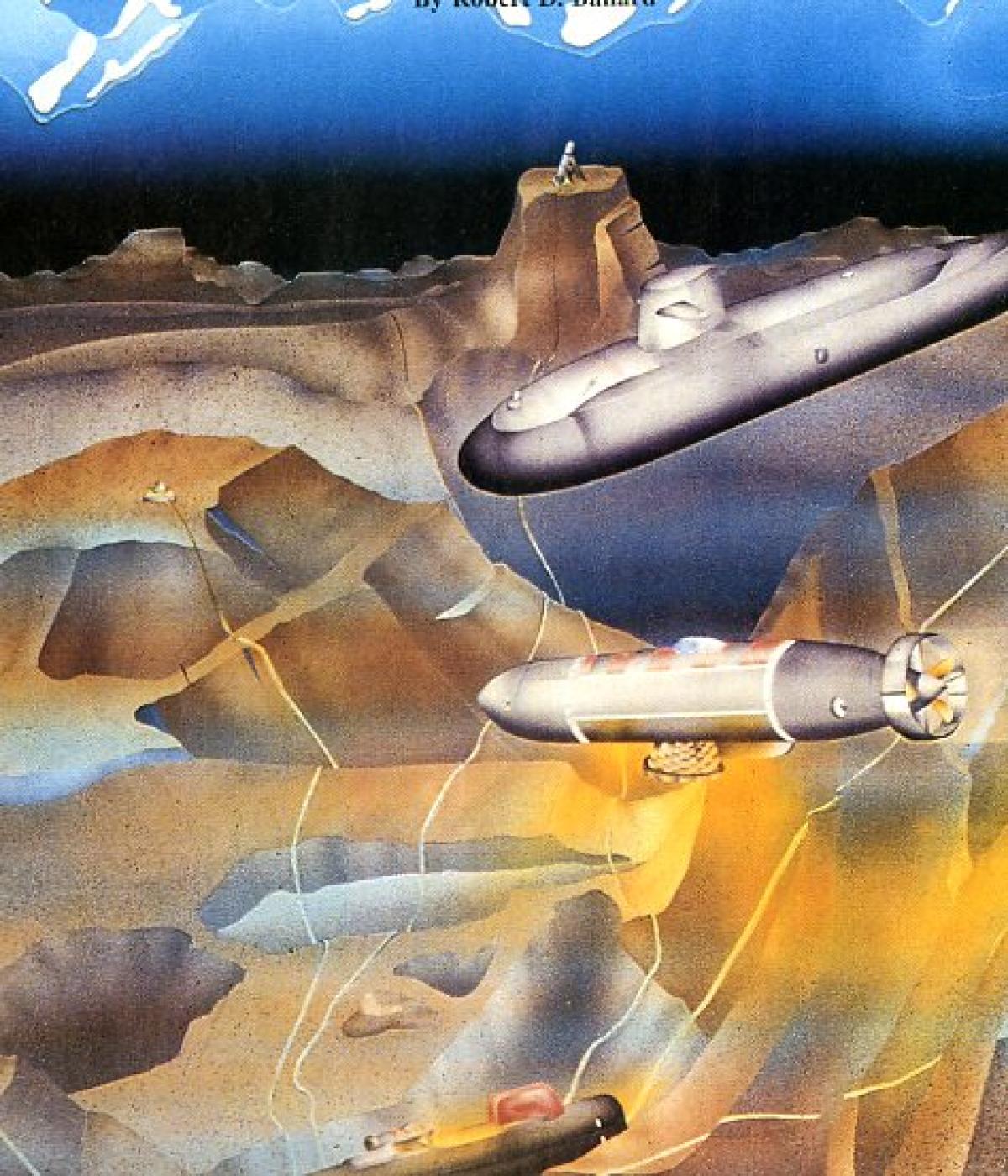
Does undersea terrain warfare have a future? Or is it pure fantasy? One of the world's foremost ocean explorers thinks that the U.S. Navy should take a more serious look at the ocean floor as a potential next battlefield, where terrain-involved submarines like the one lurking here in an ocean valley could control targeting and weapon systems deployed on the bottom.
Knowledge of the deep-sea landscape is still in its infancy. Not until 1960 did scientists first recognize the Mid-Ocean Ridge as the largest mountain range on the surface of the planet, covering approximately 23% of its total surface. Even now, no U.S. scientist ever has taken a submersible to the largest portion of this range, which lies in the southern hemisphere.
Not until the German "Meteor" expedition in the 1930s was an echo sounder first used to probe the depths of the sea. Up to that time, deep-sea soundings employed a cannon ball attached to piano wire, a technique made particularly popular in shallow-water surveys. In the latter case, an operator actually could see the wire go slack when the ball struck bottom. In the deep sea, however, the weight of the wire far exceeded the weight of the cannon ball, resulting in reported soundings of "bottomless" oceans or ones of depths in excess of 60,000 feet! All that changed with the Meteor expedition, as oceanographers finally had a tool that systematically could probe great sea depths. What they discovered was not a flat, featureless ocean floor surface, but the outline of the Mid-Atlantic Ridge, running down the center of the Atlantic Ocean.
Even as the echo-sounder became a pervasive tool on board oceanographic ships in the 1950s and 1960s, the instrument could offer only the crudest of outlines of the deep-sea terrain. These traces, in fact, resembled a wet blanket draped over the actual topography, rendering the deepest depths invisible and reducing the most rugged terrain to a series of interlocking hyperbola.
Even though scientists knew that the actual bottom topography was far more complex than an echo-sounder could indicate, they were truly amazed by its ruggedness when they first began to enter the Mid-Ocean Ridge in tiny manned submersibles in the early 1970s during Project Famous. There, they found bedrock surfaces, steep sided volcanoes, near vertical fault scarps, and deep "gars," or fissures, cutting across fresh lava flows. A few years later, during dives in the Galapagos Rift, scientists encountered expansive volcanic terrain, with cavernous lakes of once-molten lava.
In hindsight, they should have expected to find what they found. The terrain of the ocean basins of the world is complex and naturally similar to geologic features found on continental land masses.
Given the fact that the oceanographic community was slow to learn this truth, it is not surprising that the naval community still is essentially unaware of this reality and, more critical, has yet to think about its strategic and tactical importance to the future of naval warfare.
Ironically, the U.S. Navy keeps the largest and most accurate database in the world concerning the complexities of this deep-sea environment. Its reason for collecting such detailed topographical data, however, was not to appreciate its value in future naval warfare planning. The Navy collected it to support the U.S. ballistic-missile submarine program during the Cold War.
In the 1960s, about the time oceanographers were becoming aware of the mountain ranges lying beneath the sea, the Navy's submarine program began mapping large areas of the ocean, where ballistic-missile submarines were being deployed.
Using a hull-mounted sonar system called the Harris array, World War II-era Liberty ships began criss-crossing the northern hemisphere, carefully mapping vast regions of the Pacific and Atlantic oceans. All the maps were classified "Secret" and were seen by only a few people. In fact, most officers in the Navy at the time were unaware that these data even existed.
Not until the beginning of Project Famous in 1972 did the oceanographic community become aware of this mapping program. After considerable persuasion, the Navy agreed to use the USNS Bowditch (T-AGS-21) and the USNS Dutton (T-AGS-22) to survey, in detail, the complex rift valley of the Mid-Atlantic Ridge and produce the first series of unclassified maps.
These maps had a profound impact on members of the oceanographic community, mobilizing them to seek access to an unclassified version of this mapping system, named "Seabeam." Although Seabeam lacks the resolution of the Harris array or "SASS system," as it was called, it has 16 narrow beams, 2 2/30 on a side.
Throughout the late 1970s and 1980s, Seabeam systems found their way onto research ships around the world, as scientists used them to map the oceans' most complex terrain.
During the waning years of the Cold War, the upper echelons of the Navy actually did take an interest in the strategic and tactical importance that deep-sea environments might have on future naval warfare planning. In 1982, Secretary of the Navy John F. Lehman Jr. actively sought to learn more about the deep-sea environment, delivering a speech in which he advocated that the "Navy should take the high ground" beneath the sea. He even made a dive in the submersible Alvin (DSV-2) and invited me to deliver a speech at the Navy's International Seapower Symposium at the Naval War College in Newport, Rhode Island. In attendance that year was the Chief of Naval Operations, Admiral Thomas Hayward.
Fascinated by the implications "terrain warfare" might have for the Navy of the future, Admiral Hayward invited me to a series of follow-up staff briefings, where we explored such concepts.
To demonstrate my point, I asked for and was given access to the Navy's nuclear-powered research submarine NR-1, which I believe is a prototype for a future submarine design that can take advantage of the ocean's rugged bottom terrain.
The NR-1, unlike conventional nuclear-powered submarines, spends the majority of its time at sea on the bottom of the ocean or in close proximity to it. This small (150 feet in length) submarine is equipped with two oil filled wheels, making it possible for the sub to glide over the ocean floor, while observers view the bottom through three viewports. Because it comes outfitted with lateral thrusters and advanced acoustic and visual imaging systems, naval personnel quickly became comfortable operating the vehicle in the most challenging of bottom terrains.
During the summer of 1984, I spent two weeks inside the NR-1, exploring the rugged volcanic landscape south of Iceland on the Reykjanes Ridge. Diving to depths of 3,000 feet, we spent most of our time hovering within a few feet of solid rock, never hitting it. We traversed 17 individual volcanic peaks, demonstrating clearly our ability to master the terrain. In one instance, we encountered a lava tube large enough to swallow our submarine. As the dive series continued, we could not help but wonder how effective a "terrain-involved" submarine could be in a battlefield of the future.
Submarines have been used commonly over the years to plug "choke points," waiting for enemy ships or submarines to pass through them. Imagine the advantage a submarine would have if it were hiding within the bottom terrain wired to a remote network of acoustic sensors—or even weapon systems deployed across those choke points.
Based on years of diving in the most rugged terrains around the world, I am convinced that the ocean floor has great potential to future naval warfare, using both manned submarines and unmanned vehicle systems, both tethered and autonomous.
After our experience with the NR-1 in the Reykjanes Ridge, I spent the next four years working with naval officers completing requirements for their Master's degrees in Ocean Engineering at the Massachusetts Institute of Technology. Quietly, we carried out a series of studies on what a future terrain-involved submarine might look like and how it might be deployed and maintained in the field.
We called this futuristic submarine the NR-X. It was slightly larger than the NR-1 and had redundant systems so it could dive under the ice. It also had a forward torpedo compartment for the deployment of various vehicle systems. The submarine was to be towed to and from the battlefield and would be resupplied in the field using the Navy's rescue submarines Mystic (DSRV-1) and Avalon (DSRV-2).
A multi-narrow beam sonar system could conduct detailed surveys, providing the submarine commander with a battle map of the operational area. Based on an analysis of the map, the commander would then determine a deployment strategy.
Canyons and ravines would provide excellent cover for the submarine, while nearby topographic highs within the sound channel would be ideal for the placement of passive and active sonar systems as well as remotely located weapon systems, all connected to the submarine by a network of cables deployed by the submarine itself.
Once in position, a deployed network of sensors and weapon systems would be maintained by using autonomous vehicles that could be sent out from the submarine. These vehicles easily could follow the network of cables to and from the sensors or weapons. Once located, they could attach themselves to the cable for direct command and control from the submarine. Once maintenance was completed and the vehicle's batteries recharged, they would uncouple and follow the cable network back to the submarine.
Unfortunately, we were finally discovered and asked politely to discontinue our studies, particularly since the naval graduate students had designed the NR-X around a Canadian nuclear power plant.
For a short time, the Navy considered designing a replacement for the NR-1, but interest in the program evaporated with the end of the Cold War and the Soviet threat in the Arctic. The Arctic was an ideal environment for a terrain-involved submarine, given the Soviets' bastion strategy and their use of both the Arctic's shallow bottom terrain and its ice canopy overhead.
Had the Cold War not ended, it would have been interesting to see how the Soviets' basing of ballistic-missile submarines in the Arctic would have evolved. Soviet military leaders had a much better appreciation of terrain and its role in warfare than did those in United States. Lacking natural barriers on the perimeters of their country, they were forced to use what little terrain their country had, to the best of their ability. Soviet military might was based upon an army, which dominated military thinking. I cannot help but think that their bastion strategy came from the mind of a general—not an admiral.
Most Americans were comfortable with the fact that, when viewed on a Mercator map of the world, the Soviet Union seemed far from the shores of the continental United States. Few ever looked at the world through a polar projection, which showed the Soviets to be just on the other side of Canada, with a vast uncharted underwater wilderness between us.
I enjoyed pointing out to my submarine friends that a Soviet terrain-involved submarine could leave its base on the Kola Peninsula, dive beneath the polar ice cap, traverse the deep channels criss-crossing the Canadian Arctic, enter the Hudson Bay, and arrive within a short distance of Chicago, without ever entering the Pacific or Atlantic oceans.
Now that the world is in the midst of a respite from large-scale war, we should be thinking not about the last war we fought but the ones we will be called upon to fight in the future. As time passes, more and more of the underwater world will be mapped in ever-increasing detail, and I am confident that such efforts will reveal it to be even more complicated than we had thought.
The question is, when will this reality begin to affect naval thinking in the United States?
Dr. Ballard is a world-recognized undersea explorer, author, and President of the Institute for Exploration, a Division of Sea Research Foundation, Inc., based in Mystic, Connecticut.