
How can the national investment in ocean sciences get maximum value in a time of reduced budgets? Through its minimizing of duplication and waste, the U.S. Integrated Ocean Observing System (IOOS) is a large part of the solution.
Since its founding in 2002, the IOOS program has grown into an international enterprise that is delivering benefits every day. Led by the National Oceanic and Atmospheric Administration (NOAA), the program consists of 18 national agencies and institutions and 11 regional associations that serve a broad constituency of ocean, coastal, and estuarine communities. The regional associations include state, local, and tribal governments, academia, and private-sector organizations.
IOOS actively supports the U.S. National Ocean Policy, which integrates America’s stewardship of the ocean, coasts, and the Great Lakes. Presidential Executive Order 13547, “Stewardship of the Ocean, Our Coasts and the Great Lakes,” states that these entities provide jobs, food, energy resources, ecological services, recreation, and tourism opportunities, and play critical roles in our nation’s transportation and trade, as well as the global mobility of our armed forces and the maintenance of international peace and security.”
However, we cannot manage or protect what we cannot sense, measure, analyze, and communicate. Therefore, IOOS’ core mission includes integrating government, academia, and private-sector partners here and abroad who are employing a variety of ocean-science sensing and observing systems. These are linked together in a communications architecture that enhances effective decision-making and underpins important interests, from scientific and technological advances to homeland security and defense.
For example, IOOS has linkages with the Department of Homeland Security, the U.S. Coast Guard, and the Navy that merge ocean science with military intelligence, surveillance, and reconnaissance systems. Federal partner contributions to IOOS include the National Science Foundation’s Ocean Observatories Initiative, which is pushing the edge of ocean science; NOAA’s Physical Oceanographic Real-Time System, operated in partnership with local port authorities, which helps to ensure on-time delivery of goods; and the U.S. Army Corps of Engineers’ Coastal Data Information Program. These and other federal partners link to the IOOS regional associations such that the “whole” of federal-domestic ocean observation is much greater than the sum of its numerous parts.
IOOS international activity is primarily the U.S. contribution to the Global Ocean Observing System—the ocean component of the Global Earth Observation System of Systems.
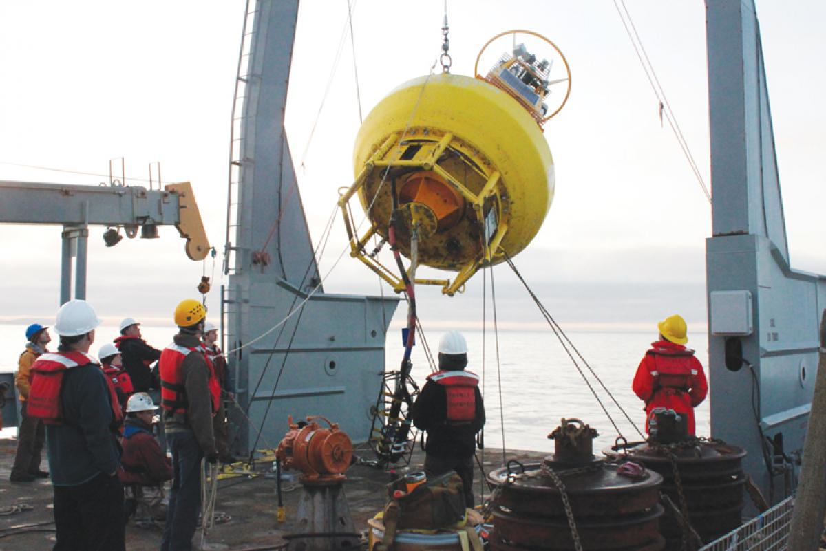
IOOS’ benefits and impact have been realized almost since its beginning. By mid-2013, within the U.S. 200-mile exclusive economic zone, the number of coastal and wave buoys has quadrupled, and real-time reporting of information is now a reality.
Reliance on fixed and mobile buoys has been augmented by the use of autonomous and guided gliders that enable collection of significant amounts of ocean information in three dimensions. During the past five years, U.S. glider operators have “flown” more than 25,800 glider-days. These submersibles are being used in applications ranging from detecting harmful algal blooms to climate research to fisheries management. The Navy is developing “littoral battle-sensing” gliders operated by the Naval Oceanographic Office. During the Deepwater Horizon incident, gliders from the Navy and the relevant IOOS regional associations were used cooperatively to understand the extent of the submerged part of the oil spill.
Among its other initiatives, IOOS coordinates innovative solutions for data collection. An example is telemetry to provide data on marine animals’ movements and interaction with their environments. The variety of sea creatures tagged is extensive: salmon, sturgeon, halibut, tuna, sharks, marine mammals (seals, sea lions, fur seals, whales, dolphins), eels, turtles, squid, crustaceans, and even seabirds.
In addition to its biological worth, knowing animal movements is also a valuable input for improving ocean forecasting. In 2012 IOOS and the Navy’s Office of Naval Research funded a project that made 3,000 tag tracks available both to Navy and NOAA modelers. These data were an important input for error reduction in forecast models.
Coordination of national ocean research programs is not an easy thing. There are the traditional competitions between organizations, large and small, for limited funding. There are a great number of people who are stakeholders, and many dislike change. However, avoidance of duplication and waste is paramount to ensure that existing funding is used as efficiently as possible. That’s what IOOS is trying to do.