
It was already an hour after sunset as the submarine's crew prepared to surface. The lookouts in the conning tower, wearing red goggles to insure good night vision when they rushed through the hatch, looked strangely intent and alert. The dim ruby lights reflected on the polished steel shaft of the periscope as it whined upward out of its well for a last look by the skipper. The Navigator had just had a swing around the horizon with the after periscope and was now glumly considering the prospect of shooting a round of stars for a much needed fix. It was already dark up there, with the horizon long since a vague blur, and he had noted a rising wind which meant plenty of spray.
This was an old story to the Navigator, and to most of the other submarine officers on war patrol that night. When on station, the ships usually dove before dawn and surfaced long after sunset. During the day, with the ship down, no sun lines were available to run up for the usual midday fix. After dark the celestial observations had to be taken with reference to a vague horizon, obscured over part of its arc by the ever present diesel engine exhaust smoke and water vapor. (Yes, they did actually smoke some in spite of the valiant efforts on the part of our very capable motor machinists' mates.) Also, the low chariot bridge and cigarette deck of the Fleet Boats were wet. If seas were not coming bodily aboard, heavy spray was, and no sextant mirror ever devised could stay clear under these circumstances.
The Navigator's mind under these trying conditions was not eased by the knowledge that his ship's bottom effectively extended to the depth to which the boat must dive if attacked on the surface. He had to know the water under the keel at all times without too frequent recourse to the Fathometer, which could readily be heard by an alert antisubmarine patrol. Also, the nature of a submarine's business was such that the ship frequently had to enter poorly charted roadsteads and harbors in search of the enemy. The deep water entrances were often mined and always patrolled, which required perilous piloting through shallow straits without benefit of any of the usual navigational aids. Retirement after attack many times resulted in high speed surface runs through these same dangerous waters while under fire, a situation not calculated to add years to the life of the Navigator. What methods were then developed to meet these rigorous conditions? Perhaps they will be of interest to others who at one time or another have faced similar situations.
First of all, why can't the marine sextant be used after dark when the horizon is uncertain? Well, perhaps because a skill or technique hasn't been developed to make it possible. There are some tricks that make it easier, however, and that will produce satisfactory fixes under almost impossible conditions of overcast, squalls, and spray. Each individual, of course, may not find them equally effective. Good night vision, however, coupled with persistence in practicing steadily for a week or so, will do wonders in developing confidence in this use of the sextant.
For varying conditions of darkness and wetness, certain modifications were made to the sextants. For moon-lit nights, the telescope furnished with the ship's stadimeter was found to be of help. A special telescope was made by many navigators by applying a hacksaw to the bridge of a pair of six-by-thirty binoculars which had previously been thoughtfully surveyed, and then mounting one side in a bracket fitted to the telescope holder. This worked well on starlit nights with a fairly sharp horizon. On the nasty nights (which so often seem to precede a landfall), employing no telescope at all was found by the author to be most satisfactory, but using both eyes to sense the line of the horizon over the complete arc of vision. When spray was a problem, the spare sextant was used. It had been modified by cutting away the clear portion of the horizon mirror, leaving only the silvered half. With no glass, there was no fogging. A caution must be inserted at this point, though. This rig is nearly as hard to become accustomed to as the inverted-image star telescope furnished in each sextant box to unwary navigators for the past generation.
Now how about the actual observations. As everyone knows, false horizons exist in the presence of moonlight and rain squalls. Therefore stars should be selected on bearings away from the moon and avoiding sections of horizon known to be obscured. To average out errors which are bound to exist, altitudes should be taken by alternately bringing the star down to the estimated horizon and then up to the horizon from below. Five or six altitudes in each direction should be enough. Take second differences to indicate wild shots which should be thrown out. Take the average of the remaining altitudes and times. Repeat this procedure with several other stars on the most satisfactory bearings, and then plot for a fix.
Often the moon must be selected as one of the bodies to shoot. The horizon under the moon is hardly ever satisfactory. This does not embarrass the resourceful navigator, since he can resort to the "over the shoulder" or "Annie Oakley" shot. Here again practice is necessary, but the results are worth while since the moon, and stars near the moon's azimuth, can be referred to the more satisfactory horizon away from the moon's bearing.
This technique is known to many navigators but not frequently used. It is accomplished by facing away from the observed body and bringing the actual lower limb over the zenith and down to the horizon. The angle read on the sextant will of course be greater than ninety degrees; and the arc followed by the body, as the sextant is swung slightly, will be opposite to that normally experienced—that is, concave downwards instead of concave upwards. With practice, one can become accustomed to this. Suitable shade glasses must be used to reduce the relative brightness of the moon. Subtract the sextant reading from 180 degrees plus twice the dip angle for the height of eye, and treat the result as an ordinary uncorrected sextant altitude. The semi-diameter of the moon in this case must be added to the final uncorrected sextant altitude. If the upper limb were selected, it would be subtracted. A quick look at the sketch on the following page will show why this must be so.
The techniques described in the preceding paragraphs make the job easier. The point to remember, though, is that satisfactory fixes can be obtained on dark nights with the marine sextant, if the Navigator has good night vision, is completely dark adapted and is willing to work at it until sufficient skill is developed.
By this time many readers have wondered why the bubble octant would not be much easier to use under such circumstances. Again it is a matter of preference, and depends on the skill of the person handling the instrument. The motion of a submarine on the surface makes the octant difficult to use because the inertia and damping of the bubble causes an appreciable lag in its motion. In general, aboard submarines the marine sextant gave more accurate fixes than the Pioneer Aircraft Mark IV Octant.
With the octant, as in using the sextant, some tricks are useful in getting the best results. First of all, to reduce the motion of the ship in the line of sight, it was found most effective to change course so as to head toward the body being observed. This gave a minimum of bubble motion. Then, using the recording drum, a two-minute observation was made, continuing to follow the body as it changed altitude. Watch time was taken on starting the run. On completion, the paper chart was removed from the recording drum. The record chart when laid fiat shows a trace, or line, graphically indicating altitude versus time. How can we tell what part of the line is most accurate—in other words, what altitude and time is most correct?
One way of selecting the optimum is by comparing the observed rate of change with the predicted rate. The observed value is the slope of the altitude versus time curve on the record chart. The predicted rate may be determined with sufficient accuracy by a formula recommended to Submarines, Pacific Fleet, during the war.
sin Z cos h = rate of change of altitude
h = altitude
Z = azimuth of body
When examined at its limits this formula holds up. For example, the maximum rate of change occurs at zero altitude and 90° (or 270°) azimuth:
sin 90°. cos 0 = 1
Minimum rate of change occurs when either the azimuth equals zero (or 180°), or when the body is in the zenith, at which times the formula will equate to zero.
A convenient way to apply the results of this computation is by means of a transparent card the size and scale of the record chart, with lines inscribed thereon having slopes between .2 and .8. A line with the calculated slope, then, can be superimposed on the trace, and where the two show the most coincidence, an altitude and time may be selected for plotting.
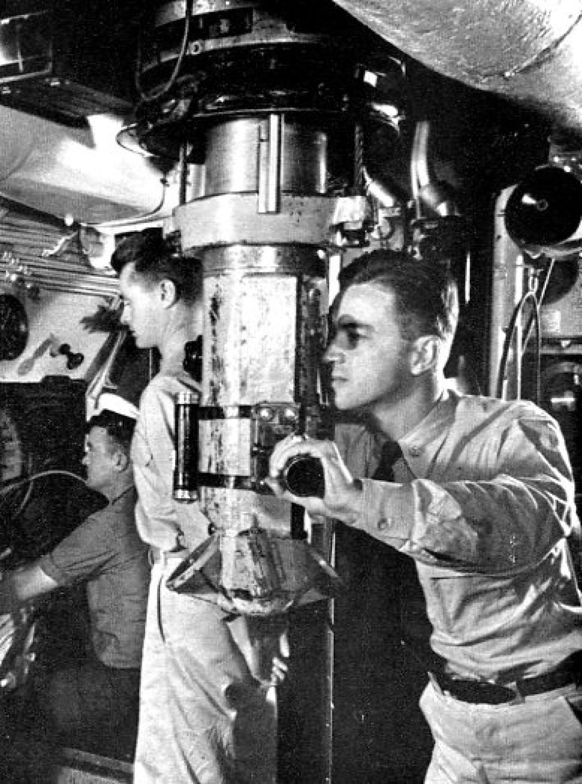
So much for celestial observations on the surface. But how about the long day submerged? Is it possible to get a celestial line of position through the periscope? The answer is yes, but only within certain limitations. A method devised in late 1943 worked well and is so simple that it must have been tried before by others, though possibly not recorded.
The periscope stadimeter may be used to measure altitudes as high as seven degrees above the horizon. Here again the conventional Navigator will take exceptions to our methods. "First they shoot them in the dark, and then they shoot them below ten degrees altitude like the book says not to do. How do those dudes ever get their ships home again?" Well, in wartime it was often refreshing to throw the book away. Here is a case where it was justified. The low altitude sight can be used with confidence, and when no other is available should be accepted as a reliable line of position, providing temperature and barometric pressure effects on refraction have been applied.
Here is the method. By offsetting the stadimeter so that its vertical scale zero line coincides with the periscope field seven degree line, a false horizon appears in the periscope exactly seven degrees above the true horizon. 'When sun, moon, or planet is either rising or setting and is nearly seven degrees high, the periscope is briefly exposed, a quick search made around the sky and horizon, and then the body carefully watched as its lower limb approaches the false horizon. At the instant of crossing, watch time is noted, bearing of the body and keel depth of the ship recorded, and the periscope lowered. If the ship has just previously submerged, the most recent surface temperature and barometric pressure are taken from the log. If the ship is about to surface, as in the evening, these values are measured after coming up. The observed altitude is then corrected as follows: (References are to the 1943 printing of "American Practical Navigator" by Bowditch).
- Index correction—none.
- Dip of horizon—calculate from Table 18, Bowditch, entering with height of periscope window above the water as calculated from keel depth. Subtract from observed altitude.
- Parallax—obtain from table 20, Bowditch, and add to observed altitude.
- Semi-diameter—obtain from the air or nautical almanac. Add to observed altitude if lower limb is used. Subtract from observed altitude if upper limb is used.
- Refraction—obtain mean refraction for standard conditions (barometer 30 inches, thermometer 50°F) from Table 22, Bowditch. Make corrections for actual temperature and pressure of surface air from Tables 25 and 24 in Bowditch. Subtract the corrected refraction from the observed altitude.
The sight is worked by any of the usual methods, comparing the corrected observed altitude with the computed altitude, and obtaining a line of position. The observed azimuth is compared with the computed azimuth to find compass error. If by chance the moon or a planet is rising as the sun sets, or vice versa, and sufficient difference in declination exists, a fix can be obtained by this method. By running such lines back to a good star fix obtained just before diving, or advancing to a good fix obtained just after surfacing, this method was found to give lines passing within an average of five miles of the ship's correct position in over fifteen observations.
Abnormal atmospheric conditions must be considered when using these low altitudes, and only experience can help here. Refraction may be excessive in the evening after a hot calm day. As a rule, however, these sights proved to be very reliable and were a welcome source of information on some occasions.
One more situation remains to be considered. How can radar best be used when piloting in restricted waters? Much has been written on this subject, and several excellent devices have been added to ship's allowances to help the Navigator get the most information from his radar. A very simple but extremely effective technique was used in the Barb while running the treacherous straits between the islands of the Kurile chain. Landfalls were made in fog after many days without celestial observations, and the straits were run at high speed through narrow patrolled channels with perfect confidence as to the ship's position. In fact, the accuracy of the method enabled corrections to be made to existing Hydrographic Office Charts, showing where the volcanic islands had risen from the sea or submerged, changing their shore lines by several miles. The idea was suggested in a Destroyers Pacific Radar Maintenance Bulletin during the spring of 1944, and is well known to many navigators in the form of radar harbor maps, and by name as the Scherini method of Radar Navigation.
Briefly the method depends upon the fact that the surface search radar transmits its beam in essentially a straight line which will intersect a land mass at a given altitude contour. When a ship is approaching land, the nearest radar indication may be a reflection from a contour at the 3,000 foot level, let us say. As the ship comes closer, the contour reflected approaches the shore line as a limit. To use this phenomena it is only necessary to have contour maps of the area in question and to superimpose on them at any time the radar presentation.
A convenient way to accomplish this is as follows. Select a chart or map showing contours (aircraft strip maps work very well). Make a plotting board of lucite with radial bearing lines and concentric range circles, laid off to the same scale as the map selected. Leave a hole in the center for a pencil.
Plot on the lucite board, about five degrees apart, the ranges and bearings to the closest contour of land shown by the radar. Fair in these points giving a line on the plotting board which duplicates the closest land contour shown on the radar scope (polar presentation), but to the scale of the map. Slide the lucite board over the map until a contour is found which matches the plotted line. There can be only one position that fulfills this requirement and the exact matching of the contour is extremely easy. A pencil mark in the center hole represents the ships' position on the map, and one might say is a fix determined by the intersection of an infinite number of lines of position. Such positions can be plotted every two or three minutes without difficulty, giving a nearly continuous track. Set and drift of current are readily observed, permitting compensation to be made before the ship has been carried very far from the desired course.
Most of the techniques which have just been described are unnecessary in peacetime under ordinary circumstances. As long as harbor pilots can be hired, Loran is available, and navigational aids are in use, such arduous methods, which admittedly require some practice and skill, need not be used. But lest the arts of war be lost in times of peace, they should be recorded for reference. Beyond this they are offered to give confidence to Navigators, who, knowing such methods have been successfully used, will be able to call on them when an emergency arises.
A graduate of the Naval Academy in 1938, Commander McNitt served in the heavy cruiser Chicago and the destroyer Rhind before entering the submarine service in 1942. He made wartime patrols in the U.S.S. Barb in both the Atlantic and Pacific, during which experience he learned the navigation techniques explained in this article. After completing a three year postgraduate course in Ordnance Engineering, he is now serving as Gunnery Officer on the carrier Midway.